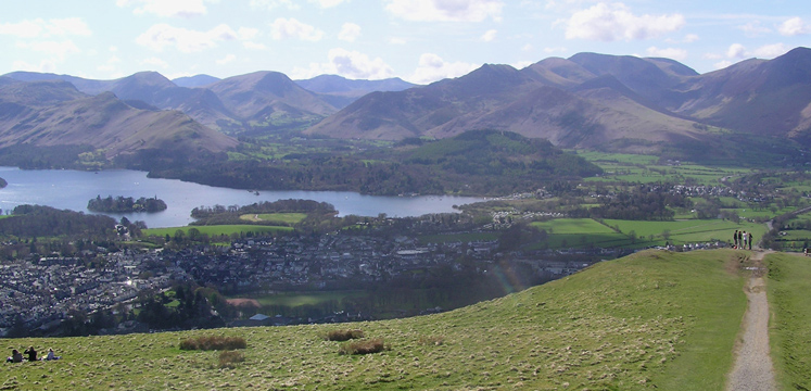
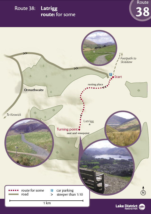
A short (1km each way), but initially steep walk to an amazing view of Keswick and Borrowdale - OS Explorer Map OL4.
Go through two gates at the head of the car park where there is a sign for the Latrigg limited mobility path. The steepest part of the climb beckons, with a 1:7 gradient for 150 metres. The surface is well compacted stone but the steepness means that we do not recommend this route for people operating their own wheelchairs. If using mobility equipment please be sure that this is capable of climbing the slopes and that you are able to control your descent.
There is a resting place as the gradient eases to 1:10. Take a break here and look back at the grandeur of Skiddaw, Lonscale Pike and the western end of Blencathra.
The route drops slightly downhill until a junction with a public footpath. From here, the track rises again steadily at around 1:10 until a small plateau is reached - and a bench seat. Be prepared to have your breath taken away as the views of Derwentwater and the Borrowdale valley unfold. On a good day, most of the highest mountains in England - Scafell Pike, Great End and Great Gable - should all be seen at the head of Borrowdale and Helvellyn is over to the left.
The summit of Latrigg is not far away, but the path is steep and uneven. You need to retrace your route to get back to the car park. Be careful on the steep slope.
Car park at the head of Gale Road.
Postcode: CA12 4PH
Grid reference: NY 281253
W3W: ///visitor.whisker.partner
Grid reference: NY 276246
W3W: ///florists.panics.songbook
None on the walk, nearest toilets and refreshments in Keswick.
Car: A591 Keswick to Bassenthwaite road, via Applethwaite or Ormathwaite.